
National Historic Trail
California National Historic Trail
Follow in the footsteps of over 250,000 emigrants who traveled to the gold fields and rich farmlands of California during the 1840s and 1850s: the greatest mass migration in American history. The California National Historic Trail is over 5,000 miles long and covers portions of 10 states. Step into history along more than 1,000 miles of ruts and traces from travelers and their overland wagons.
Official NPS pageHours
The California National Historic Trail is not a clearly marked hiking trail. Instead it is a corridor that passes through communities, urban areas, public lands, and Wilderness. The route travels across a variety of land ownerships and management, including private land. Each location varies as to the hours of operation and access. Please contact individual trail sites before your visit for more information.
Entrance fees
No entrance fee listed.
Getting there
Those portions of the California National Historic Trail authorized by Congress include nearly 2,000 miles of historic trail that was once the primary "road" taken by farmers, enterprising business managers, gold-seekers, and fortune hunters who chose to make a new life on the California frontier. The route passes through ten states from Missouri to California.
Things to do
Become a California Trail Junior Ranger
Learn about the California Trail and earn your junior ranger badge! This activity can be completed virtually or after visiting a site along the California National Historic Trail. Worksheets can be submitted either electronically or by mail. Take a look and start exploring the trail today!
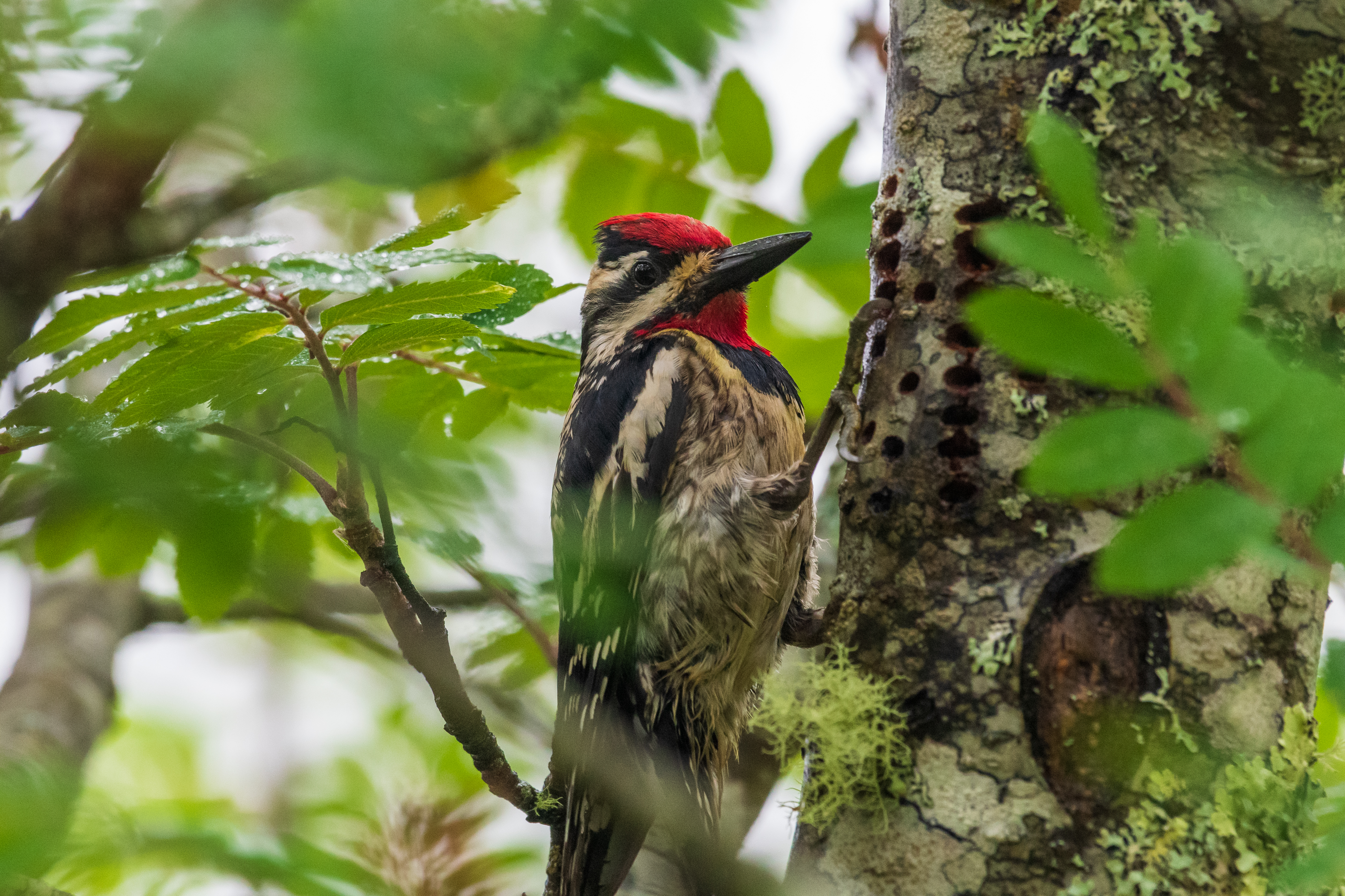
Birdwatching on the California Trail
Emigrants on the California Trail were introduced to many new plants and animals as they made their journey west. With over 2,000 miles of trail, through countless habitats, there are a number of places where you can have a similar experience! The following places along the trail are noted for their birdwatching opportunities. Check them out!
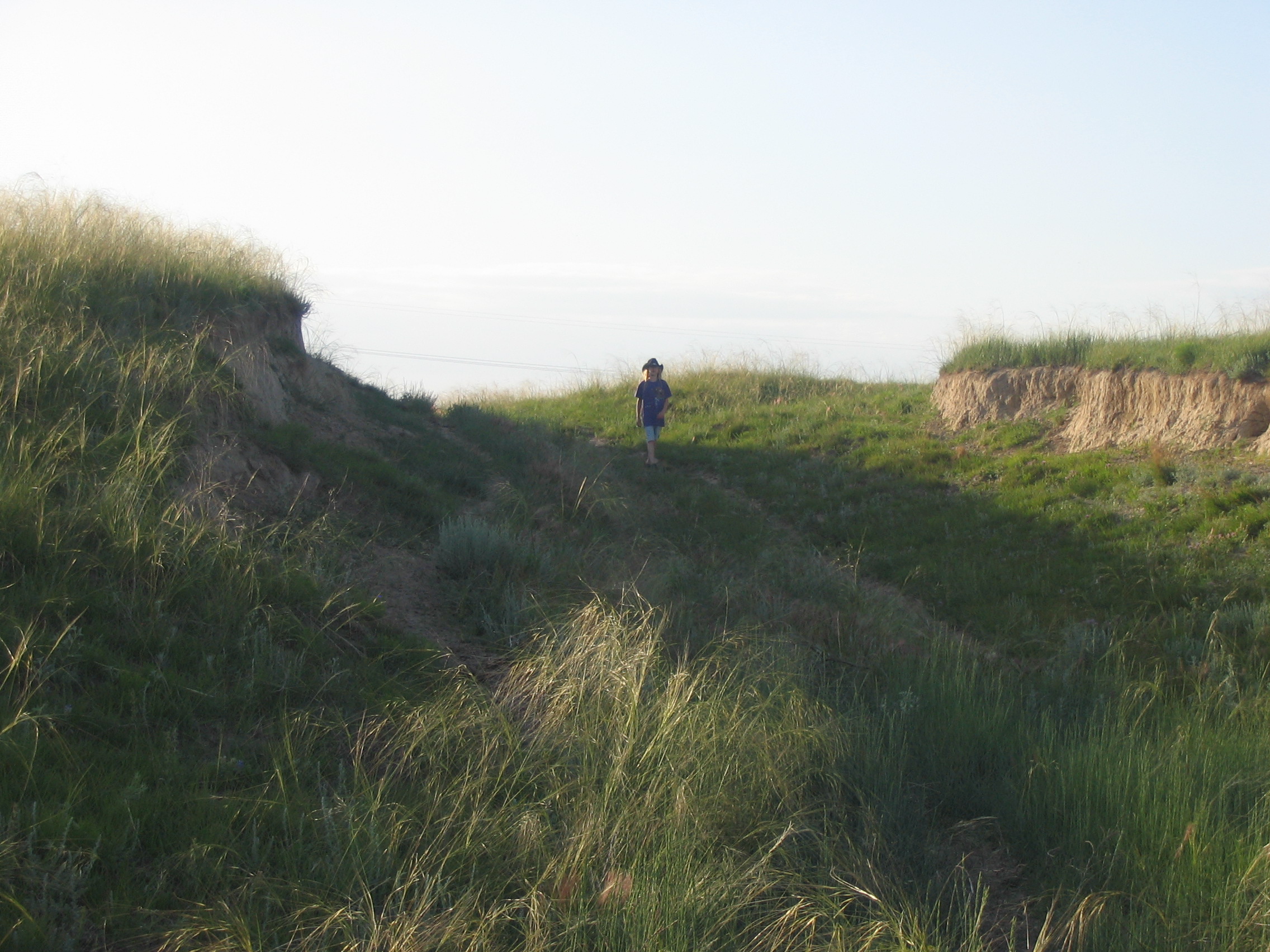
Go See Oregon Trail Ruts
One of the best ways to experience the Oregon Trail is by taking a step back in time while visiting a trail rut. Luckily, there are still places where you can have that experience today. Take a look at the the list below and plan your visit to the mid-1800s today!
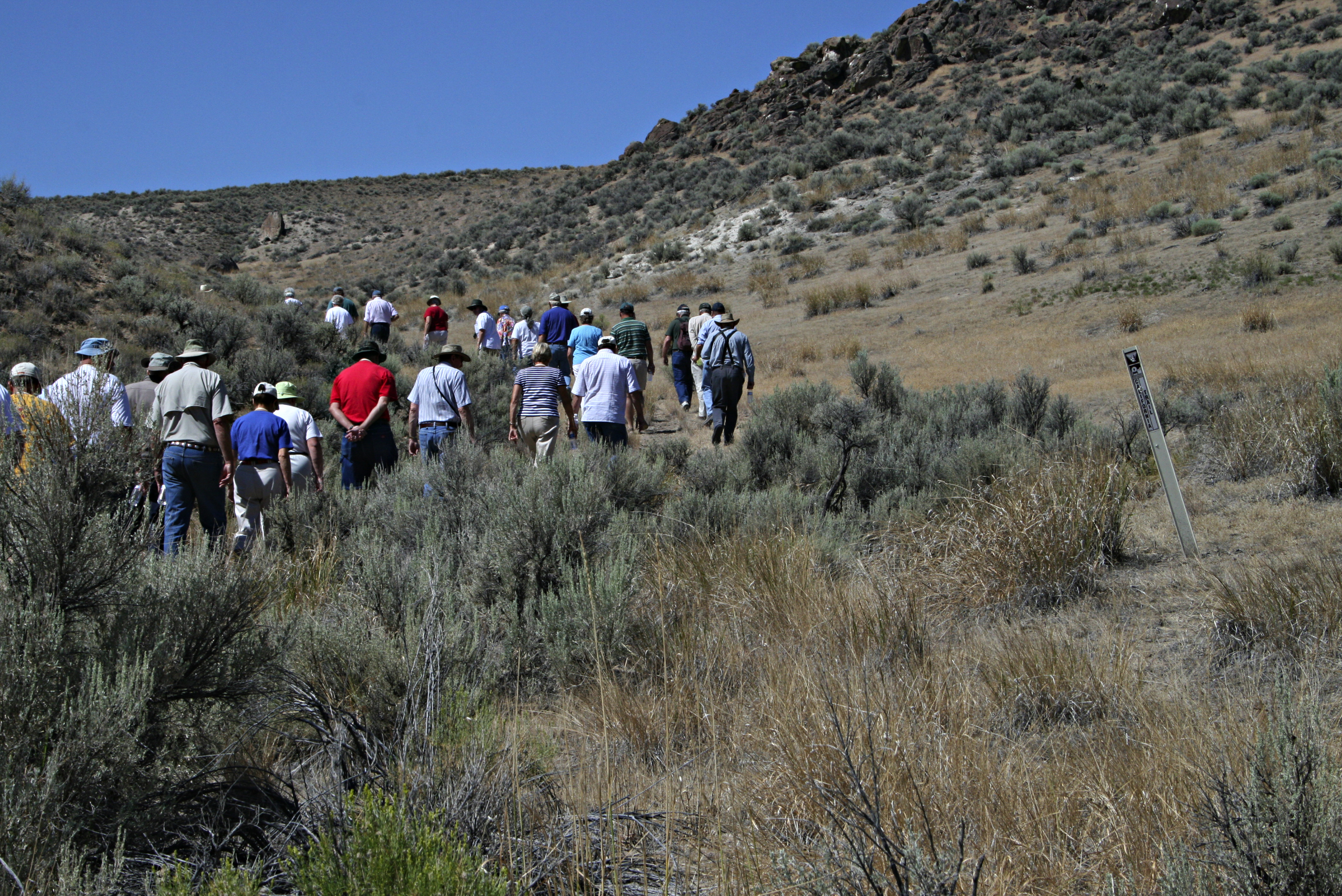
Hike on the California Trail
Follow in the footsteps of over 250,000 emigrants who traveled to the gold fields and rich farmlands of California during the 1840s and 1850s: the greatest mass migration in American history. There are a variety of hiking opportunities across the full length of the trail. We've selected a few places in Idaho, Nebraska, and Wyoming for you to check out.
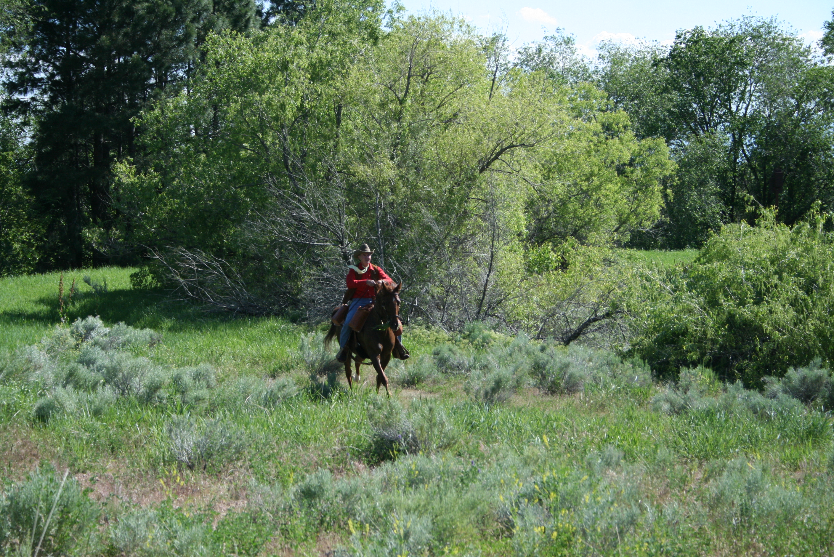
Horseback Riding on the California Trail
Take a ride back in time on the California Trail! The variety of opportunities ranges from historic landscapes to modern views, and from short to longer trail rides. Riding the Trail is a great way to connect to this fascinating story of over 250,000 emigrants who traveled to the gold fields and rich farmlands of California during the 1840s and 1850s.
Check out Museums and Visitor Centers along the California Trail
There are a variety of museums and visitor centers along the California Trail. In some places, you may find more interpretive exhibits, information, and programs. In other places, being in the location will enrich your experience, even with minimal facilities. Visit one of these locations to learn more about the history and culture of the Trail.
Places to see
Lander Road Cutoff- Idaho Junction
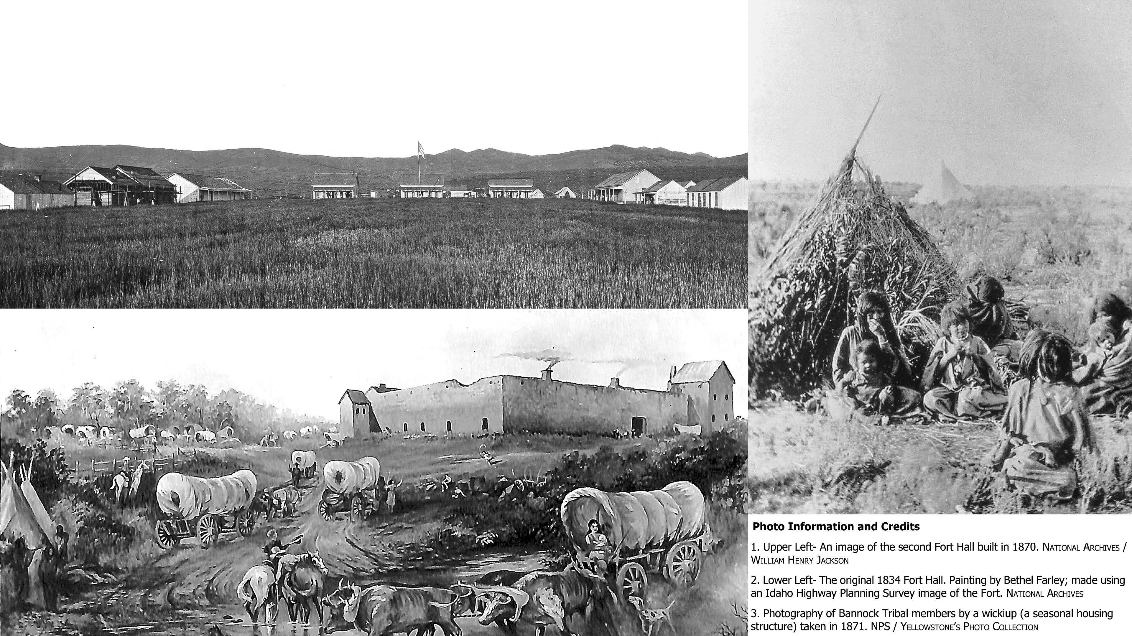
"The ceremonies were witnessed by over 300 emigrants who happened to be near at the time. The Indians were then informed...the presents that they were to receive were given them because they had been friendly to the white men, and recommended that their friendship should continue. Col Landers then addressed the emigrants, telling them to treat the Indians kindly, and live in peace together." -Albert Bierstadt, July 5, 1859 The end of the Lander Road's construction between Burnt Ranch, Wyoming, and Fort Hall, Idaho did not mean the end of the project. One item still had to be done- negotiate with the Native American Tribes whose land it was built on for the right of way. In 1859, Lander brought wagon loads of goods to give to the Shoshone, Bannock, and other Tribes in exchange for the privilege of crossing their land peacefully. On July 3, at the Green River crossing in what is today Wyoming, a celebration was held to disperse gifts to the Shoshone and to celebrate the 4th of July. The peaceful, festive celebration was attended by about 800 Shoshone, 300 emigrants (who happened to be in the area), and the soldiers and cavalrymen of Lander's command that were traveling with him. A feast was had, gifts were handed out, and speeches were made. Lander spoke directly to the Shoshone and then to the emigrants (partially quoted above). Contrary to the expected views at that time, Lander instructed the emigrants to have their interactions with the local Native Americans be cautious. They should treat the Native Americans kindly and to live in peace with them. The celebration extended into the night and concluded the following day. Several Additional celebrations and gatherings were held throughout the year with the same purpose of distributing gifts to Native Americans and negotiating with them to cross their land peacefully. In terms of Lander obtaining the needed right-of-way agreements, the negotiations were successful, concluding the first US government-sponsored trail section for the Oregon and the California Trails. Image Credit 1. Upper Left- An image of the second Fort Hall built in 1870. National Archives / William Henry Jackson 2. Lower Left- The original 1834 Fort Hall. Painting by Bethel Farley; made using an Idaho Highway Planning Survey image of the Fort. National Archives 3. Photography of Bannock Tribal members by a wickiup (a seasonal housing structure) taken in 1871. NPS / Yellowstone’s Photo Collection Site Information Location (17 miles east of Fort Hall, Idaho and the Shoshone-Bannock Tribal Business Center) Safety Considerations More Site Information Oregon National Historic Trail California National Historic Trail
Lander Road Cutoff- Lane's Grave
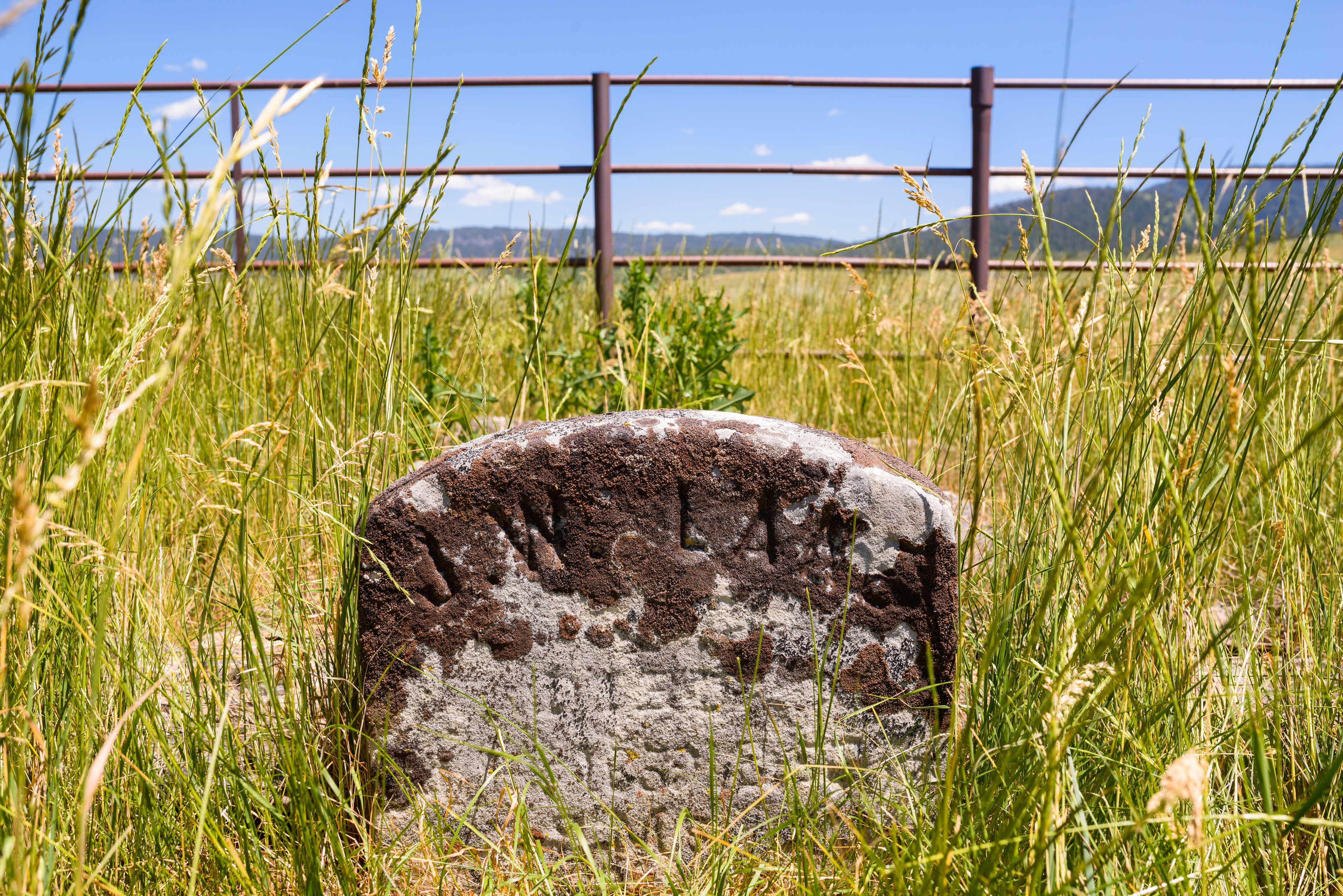
In the mid-1800s, over 250,000 people followed the California Trail to California's gold mines and croplands. Most had to walk the entire 2,000-mile trip. Would you do this? More than once? Travelers in the 1800s said “yes” to both! The California Trail was their version of today's interstate highway -- a route that could be traveled repeatedly and in both directions. Similar to interstate highways, new parts of the California Trail were created to help travelers. The first US government sponsored section was the Lander Road in 1858. John Lane used this road for the first time in 1859, during his fifth(!) trip on the Oregon and the California Trails. He was the captain of a wagon train that departed Iowa for Oregon. Sadly, he did not complete the trip. On July 18, on a nearby ridge off of the Lander Road, Lane died from a cholera-like illness. With limited supplies, and limited time before winter's arrival, most trailside burials were quick- simply prayers said over a hastily dug grave. However, the beloved Lane received a unique honor -- a funeral! There was a customary viewing of the body, hymns, prayers, and a funeral procession. Finally, a headstone made by a wagon train member was placed at the grave. After the day-long event was over, the wagon train returned to the Trail and its journey to Oregon. Site Information Location (Lane's Grave, Caribou County, Idaho, 17 miles west of Freedom, Wyoming) Today, little has changed at the grave of John Lane since he was buried. The headstone and footstone still remain, it is only accessible by a dirt and gravel road, there are no public services, and very few structures or homes are visible from the grave. The site is a rare opportunity to experience, as close a possible, what traveling the California Trail in the 1850s was like. The grave itself is on private land. Visitors are welcome to view it; however, it does require calling the land owner when you arrive as there is a locked gate across the road to Lane's Grave. Safety Considerations Oregon National Historic Trail California National Historic Trail
Bear River Crossing - Beartown
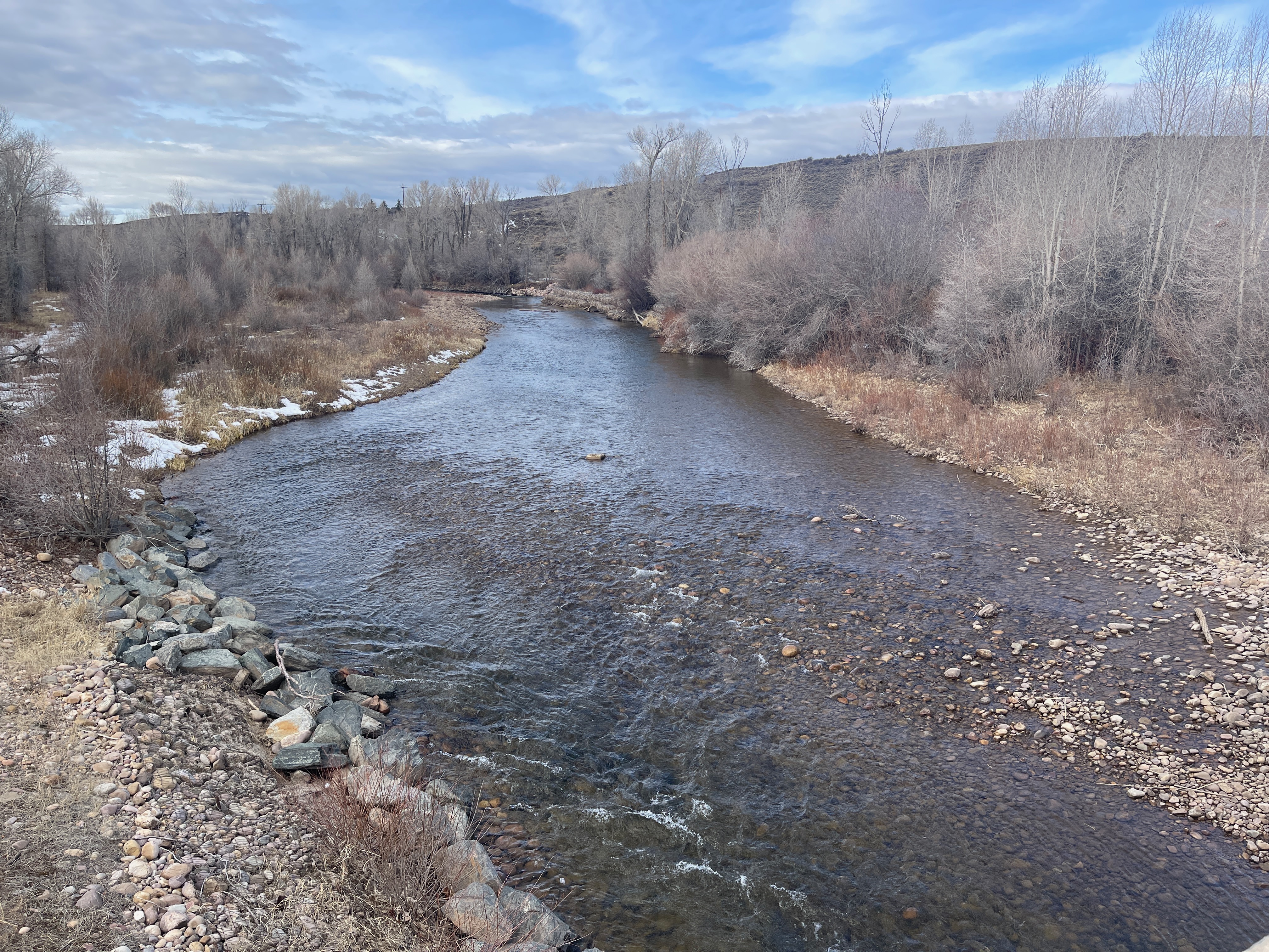
Several places related to the Mormon Pioneer, Pony Express, and California trails are along this 2-mile stretch of highway southeast of Evanston, WY. From Evanston, take I-80 Exit 5 onto southbound WY-150 and drive 9 miles to the highway bridge over the Bear River. Pause there to look south (right) to view the Bear River Crossing below the bridge, where wagons, handcarts, and mule trains forded the stream or crossed on ferries or bridges during the 1840s-1860s. California-bound Edwin Bryant, crossing with pack mules in 1846, described the ford as about 50 yards wide, “with a rapid current of limpid water foaming over a bed so unequal and rocky, that it was difficult, if not dangerous to the limbs of our mules, when fording it.” Continue south for 0.3 mile to a gravel turnout on the left. Beyond the livestock loading ramp at the edge of a ranch yard stands a silver post marking the approximate location of 1860-1861 Pony Express Bear River Station, which also served the Overland Stage from 1858 to 1868. Nothing of the station remains; please do not enter the private yard. Return to the highway and continue for ¼ mile to enter gravel drive on the left. There, view a stone monument honoring the 1847 Latter-day Saint pioneers. Behind the monument stands a granite marker that tells about the Pony Express and Overland Stage Bear River Station, and nearby lies a simple stone moment to a Willie Handcart Company emigrant who died in 1856. Return to the highway and turn left. A mile ahead, a brown sign points to a state historic sign for Bear River City, on the left. A series of historical signs there tell about this rowdy “Hell-on-Wheels” town that served Union Pacific laborers working to build the transcontinental railroad in 1868. Nothing remains at the townsite today except leveled ground and modern, privately owned buildings. Turn left onto the highway. At the curve about 300 yards ahead, pull over and look north (left). The original trail corridor approached from that direction before abruptly turning right along today’s highway alignment. The pasture to the south (right) figures importantly in the Mormon Pioneer Trail story. After an 18-mile trek through mountainous country, Brigham Young’s company stopped here July 10-11, 1847. Mountain man Miles Goodyear visited the camp, offering encouragement and useful travel advice. While there, Brigham Young and others fell ill with “mountain fever,” a tick-borne disease that causes high fevers, severe headaches, body aches, delirium, and sometimes death. Camp scribe William Clayton noted that the leader had grown “insensible and raving” but was “a little better” in the morning. Young’s sufferings over the next 2 weeks caused him to fall 1-2 days behind the rest, making him among the last of the vanguard company to enter the Great Salt Lake Valley. Many other wagon parties camped at this location through the 1840s-1860s. This is the last of the trail-related historical sites on this stretch of highway. Site Information Location (Several markers, monuments, and sites are along a 2-mile stretch of WY-150 S, beginning at the Bear River bridge about 7.75 highway miles south of I-80 Exit 5, Evanston. Beginning of the stretch: River Crossing view from bridge is at GPS 41.168217 -110.87571; Nardone station marker post GPS 41.166438 -110.873375; 1924 Brigham Young monument GPS 41.165926 -110.869341; Bear River City historical marker and kiosk GPS 41.157881 -110.850866; end of stretch, view of MOPI 1847 Sulphur Creek Camp and later Hell-on-Wheels town Bear River City (aka Beartown) GPS 41.155631 -110.848470) Mormon Pioneer National Historic Trail Pony Express National Historic Trail California National Historic Trail
Bidwell Pass
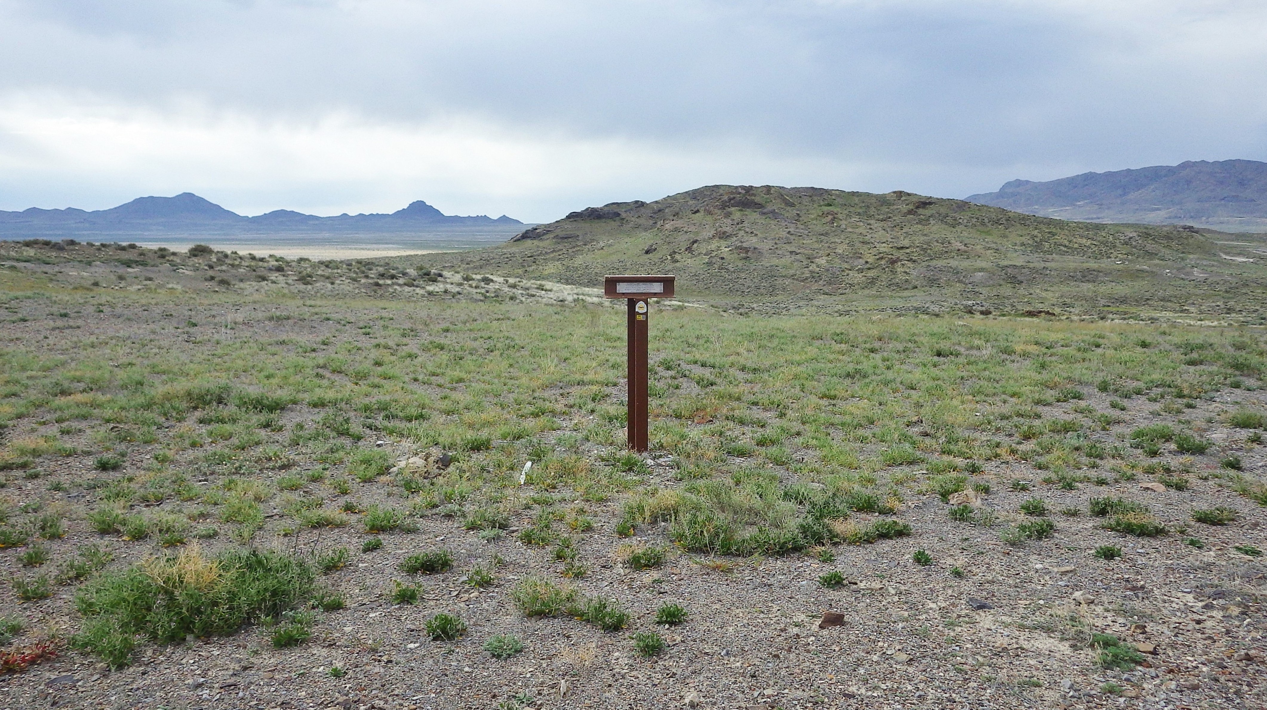
Bidwell Pass, on the southern flank of Pilot Peak, is informally named for John Bidwell, a member of the 1841 Bidwell-Bartleson Party that was first to go overland to California. John James, also a member of that party, wrote in his journal, “In the evening we left the salt plain, turned our course to the west, crossed the mountain through a gap [later called Bidwell Pass] and could find no water.” Edwin Bryant, traveling five years later with the first company on the Hastings Cutoff, found and recognized their faint track approaching the pass. “From the indentations of the wheels, where the earth was soft, five or six wagons had passed here. The appearance of this trail in this desolate region was at first inexplicable; but I soon recollected that some five or six years ago an emigrating expedition to California was fitted out by Colonel Bartlettson, Jr. J. Chiles, and others, of Missouri…” Others following the Hastings Cutoff crossed the pass in 1846-1850. Trail trace left by their wagons parallels and crosses the modern unpaved road approaching the pass. An interpretive wayside exhibit near the road tells of the trail’s history and provides a map of the emigrant trails that passed north and south of the Great Salt Lake. To reach the turnout, take I-80 Exit 4, turn north, and drive past the fuel station. At the first Y intersection beyond the station, keep left. At the second Y, stay left and drive 6.3 miles on a paved section of Pilot Peak Rd to the cattle guard at the Utah-Nevada state line. Continue north for 6.2 miles on the unpaved road to an auto tour route sign for the trail, which also marks where the Hastings Cutoff crosses the road. On the left is a turnout with an interpretive wayside exhibit and a large Bureau of Land Management sign for the Hastings Cutoff. Between them stands a t-shaped trail marker with an emigrant quote. The crossbar on the marker is aligned with the direction of the original trail, which continues southwesterly and reaches Bidwell Pass in 0.8 mile. That section of historic trail to the pass can be hiked. Because a vehicle’s hot undercarriage can ignite dry vegetation, driving the section is not recommended. Site Information Location (Bidwell Pass is on the southern slope of Pilot Peak, about 11 miles north of West Wendover, Nevada. GPS “California Lay to the West” wayside at turnoff: 40.910677 -114.0839767 GPS Bidwell Pass: 40.903328 -114.092286) Safety Considerations More Site Information California National Historic Trail
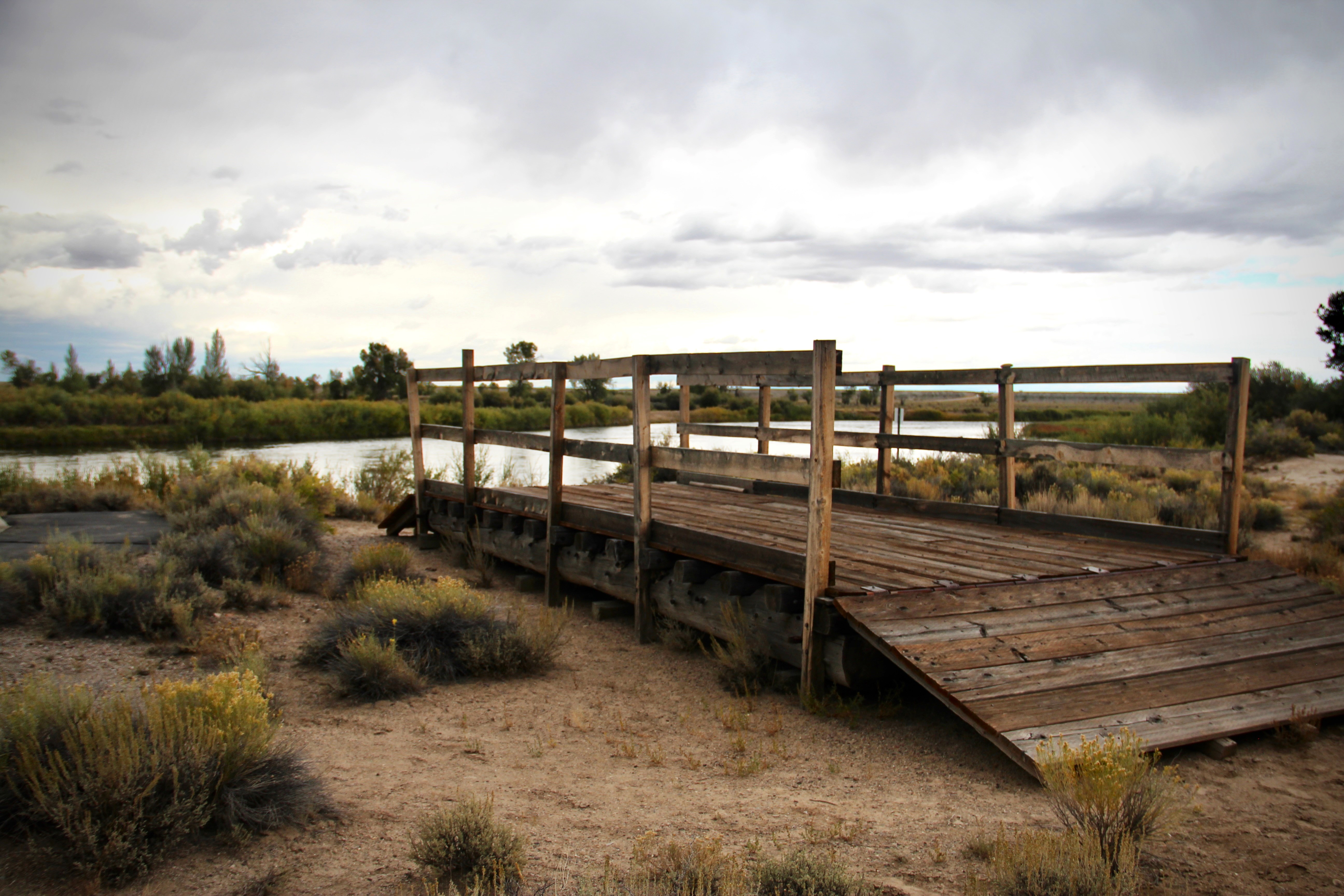
Lombard Ferry at Green River
“The Green River is dreaded by all who have to cross it,” Oregon-bound Rebecca Ketcham wrote in her journal on July 25, 1853. “It is wide, deep, and very rapid.” But all who went west on the primary overland trail corridor through Wyoming faced crossing this powerful stream, the largest tributary of the Colorado River. Travelers who reached its tree-lined banks during low-water months of summer could drive across, although some met disaster when their wagons struck a submerged hole and overturned in strong currents. Those who arrived while the Green River was swollen with spring runoff might try rafting or floating their wagons, but that was highly risky. Sir Richard Burton, traveling in 1860, reported the river to be 330 feet wide and 3 feet deep in midsummer, but 800 feet wide and 6 feet deep during high water. “It is a swift flowing stream,” he observed, “running as if it had no time to lose. . .” Men from William Kelly's 1849 company, launching in a caulked wagon box, quickly found themselves “whirled round and round in the curling eddies, and hurried down with fearful rapidity.” When the Green River raged, it was safest to cross on a ferry that was secured to ropes stretching from bank to bank. Numerous ferries operated on the Green River during the emigration era. Travelers on the trail to Fort Bridger typically boarded the one later known as Lombard Ferry, above the mouth of the Big Sandy River in present Seedskadee National Wildlife Refuge. Mountain men established a commercial ferry in this vicinity in 1843, the year of the first big overland immigration to Oregon. The 1847 vanguard of Latter-day Saints, on their way to Utah, built their own rafts to float their wagons over, then assigned some men to stay and earn money by ferrying other companies. In the early 1850's, Latter-day Saints from Utah used a combination of armed force and payment to pry the original operation away from the mountain men. It became known as the Green River Mormon Ferry until 1889, when William Lombard took it over. In the busy season, wagon traffic backed up and waited in line 2 to 3 days to cross. Often, immigrants were renting a dilapidated floating platform while having to do all the work themselves. Even so, proprietors demanded $1 to $8 per wagon, depending on the ferocity of the river currents. That higher fare is the equivalent of about $2,524 in 2025 dollars. To avoid additional fees, men and boys on horseback swam the livestock across. Drownings were not uncommon. Today the Lombard Ferry site, 18 miles southwest of Farson on WY-28, offers a paved interpretive path with 6 wayside exhibits. A wooden replica ferry rests along the riverbank where the original ferry operated, with wheel ruts created by departing wagons winding south through the sagebrush. Site Information Location (From Farson, WY, follow westbound WY-28 for 25.5 miles to the Green River. Turn left into the site immediately after crossing the Green River bridge. The site also can be reached from I-80 Exit 83. From the exit turn north on WY-372, drive 26.8 miles, and turn east (right) on WY-28. The site is about 2.5 miles ahead on the right. GPS 41.879778 -109.807517) Mormon Pioneer National Historic Trail California National Historic Trail Oregon National Historic Trail
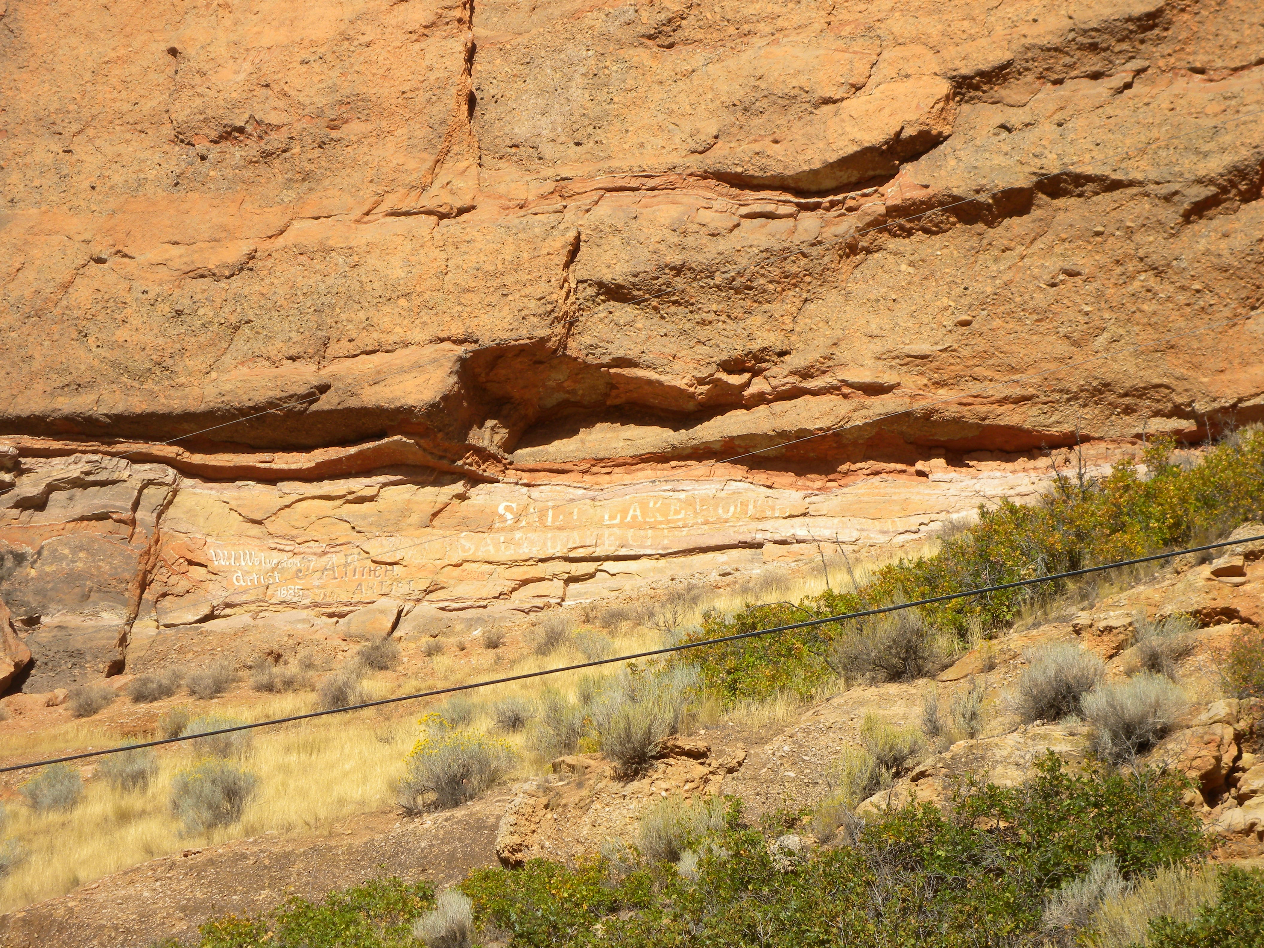
A Second Cliff-face Billboard
These hand-painted signs on the side of a cliff in Echo Canyon, Utah, advertised Salt Lake House, a popular hotel in downtown Salt Lake City (opened in 1911), and artists W. I. Wolverton (1885) and J.A. Finch (1875). The signs were intended to drum up customers who needed lodging or desired a portrait or artistic memento of their visit. They post-date the emigrant trails era but probably were seen by passengers traveling on the transcontinental railroad. To find the site, look for Summit County Tour sign No. 4 on the south side of Echo Canyon Rd, facing traffic approaching from the I-80 Echo Interchange. There is no formal turnout, but the road shoulder is wide enough for parking. Look up at the base of the cliff where spalling of the rock has created a slight alcove. The faded white letters can be hard to spot during some natural lighting conditions. Site Information Location (Echo Canyon Rd, a frontage road parallel to I-80, about 1 mile northeast of the I-80 Echo Interchange. GPS viewing location 40.990657 -111.411403) Safety Considerations Mormon Pioneer National Historic Trail California National Historic Trail
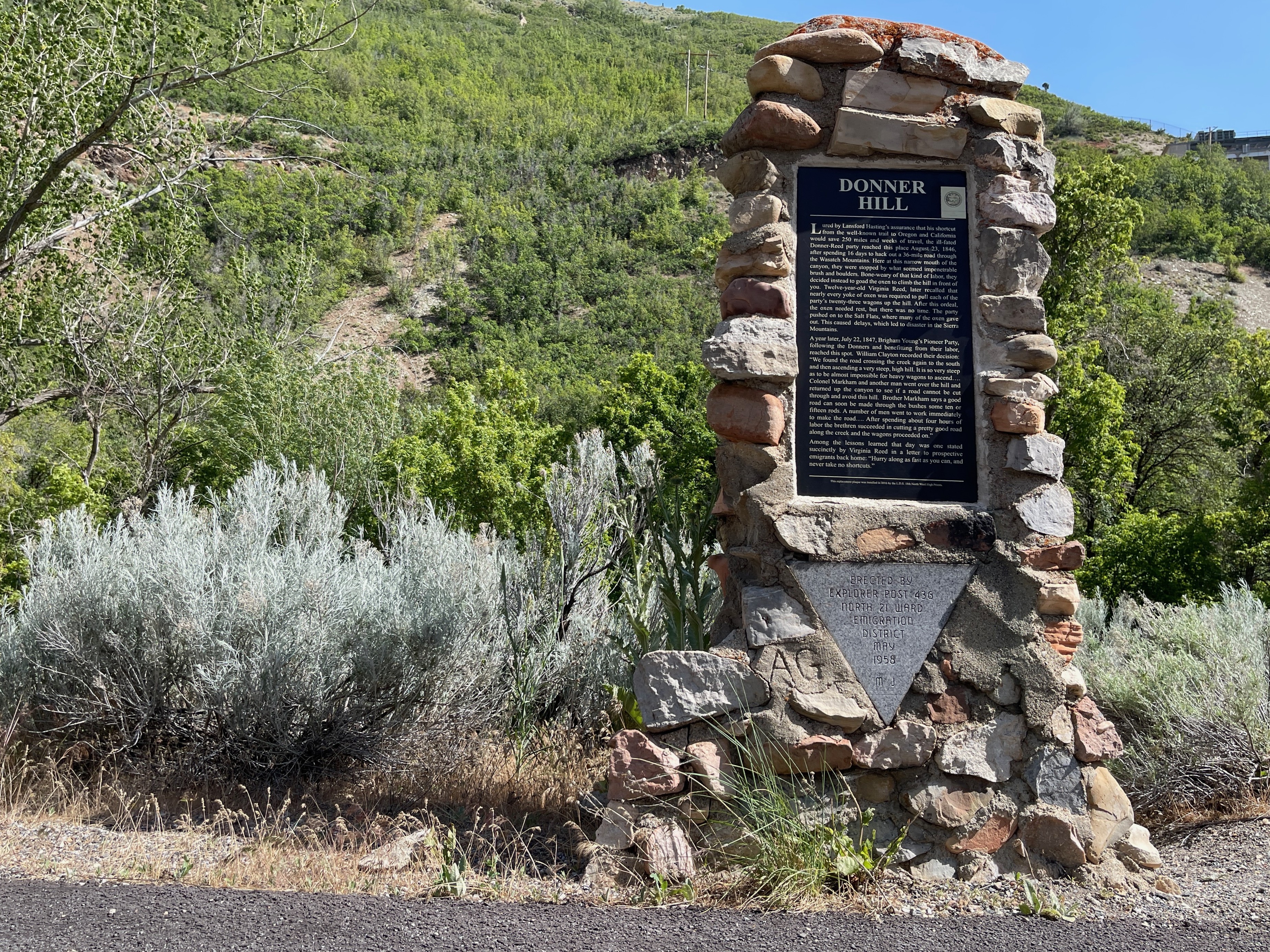
Donner Hill
Donner HIll hammered yet another nail into the Donner-Reed coffin. For 12 days the emigrants had gnawed a track through the rugged Wasatch wilderness, and now, at the very edge of the Salt Lake Valley, limestone outcrops and dense willows blocked their exit from the mouth of Emigration Canyon. The discouraged travelers pulled to the left out of the creek bottom and up the 200-foot-high ridge that thereafter would bear their name. The effort nearly used up the strength of their oxen. The next year Brigham Young’s vanguard pioneer party, having more men for the labor, opened a road through the blockage, avoiding the hill climb, in just 4 hours’ time. The current roadbed approximates their route. Today, Emigration Canyon is widened and the top of Donner Hill has been leveled to make room for residential development. But the hill is still impressive and Emigration Creek, edged by willow and scrub oak, still runs along the south side of Emigration Canyon Road. Visitors can easily envision how this spot looked in 1846-47. The evening of their arrival on July 22, the Donner-Reed Party encamped a short distance beyond the hilltop with the broad Salt Lake Valley stretched at their feet. A grassy park along the ridge, adjacent to Crestview Drive, is named Donner Park in commemoration of that campsite. The next day the emigrants descended the ridge and traveled across the valley to the Jordan River. From there, the Donner Reed Party continued along the south shore of the Great Salt Lake. Site Information Location (Emigration Canyon, near Rotary Glen Park, east of Salt Lake City, Utah.) On the right at odometer mile 20 is another small sign for Donner Hill. A stone monument commemorating Donner Hill is on the left where the road curves to the south. At that location the hill is in front of you, easy to see, with a condominium at the top. Use caution when crossing the oncoming lane to enter or leave the widened road shoulder at the monument. Then continue down Emigration Canyon Road around the S-curve. If traffic permits, turn left at odometer mile 20.6 into an unmarked entrance for Rotary Glen Park. If you miss the entrance, turn left onto the next paved road, Crestview Drive, and turn around at a safe location to return to the intersection. Turn right and make an immediate right turn into Rotary Glen Park. Now go left across the parking lot and follow the dirt access road to the east. End at a gravel parking lot. Look across the small reservoir toward Donner Hill, the ridge to the northeast. The emigrants ascended the ridge on the north side of the condominiums. From this vantage, the steepness of the climb is evident. Take the opportunity here or at the picnic area to the west to explore Emigration Creek. Safety Considerations More Site Information Mormon Pioneer National Historic Trail Pony Express National Historic Trail California National Historic Trail
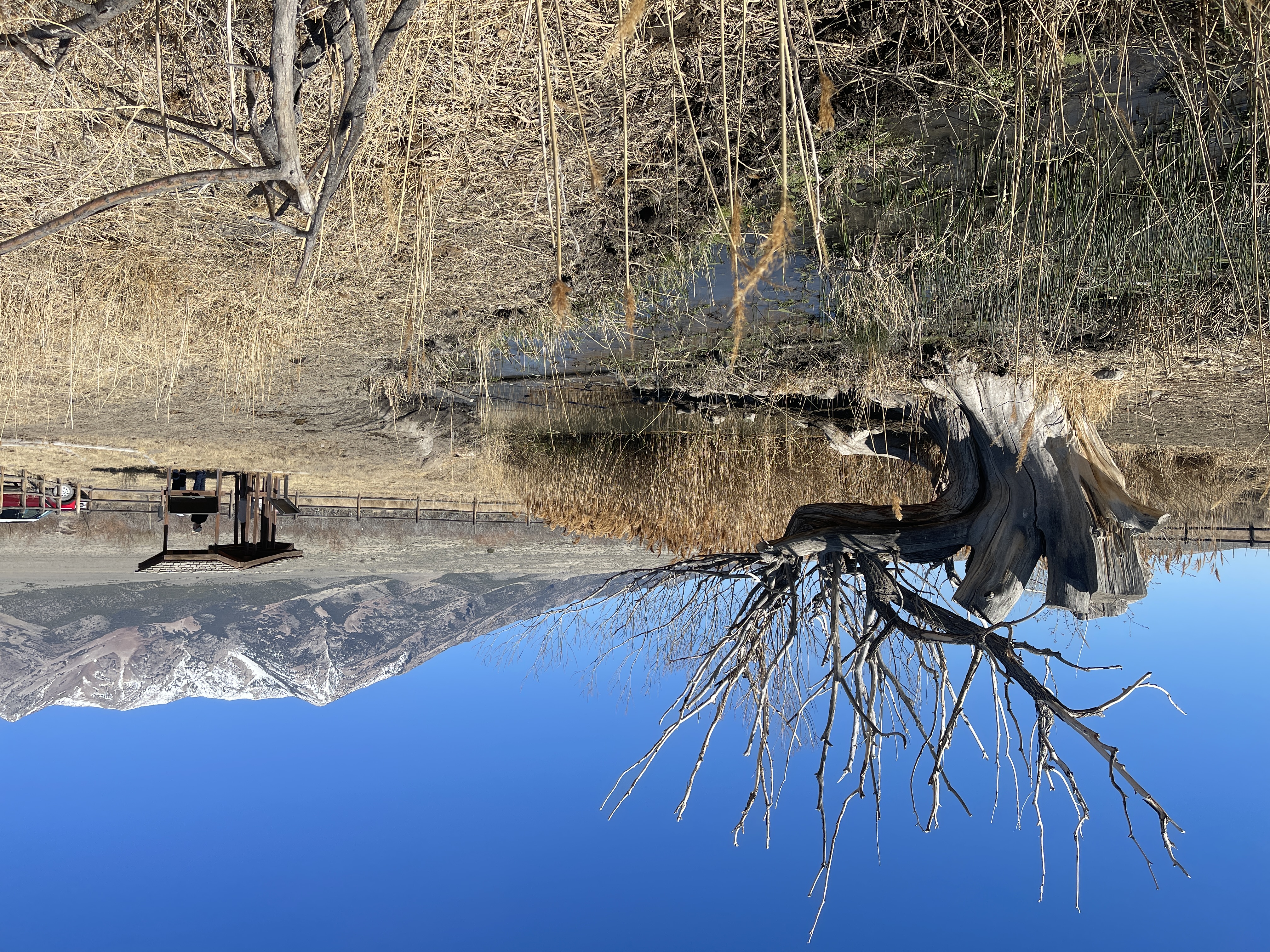
Donner Springs
The transition between the salty mudflats and the meadow surrounding Donner Spring is abrupt, literally a line in the sand. In just one or two steps, the emigrant emerged from an unearthly, white plain of suffering, littered with abandoned wagons and dying livestock, into a green oasis of water and life. The first overlanders to cross the Hastings Cutoff in 1846 arrived on Aug. 3, bushwhacking through a thicket of willows, reeds, and grass to reach the cold, pure “fountain spring.” Among that pack-mule party was Edwin Bryant, who claimed to have sounded the basin to a depth of 35 feet, and “no bottom found.” (A later emigrant estimated its depth at a more believable 5 feet.) Heinrich Lienhard rode up 16 days later after a 49-hour desert crossing on muleback, to find that advance members of his party had created a “wagon village” surrounding the waterhole. “In spite of long-sustained fatigue everyone was animated and happy,” the Swiss immigrant recorded in his native German. “The young girls gathered together and sang, while the young Americans danced to the squeaky sounds which a man…coaxed from his old fiddle, so that the dust eddied up in clouds; in short, one might have supposed the whole journey completed.” The Donner-Reed Party, last to cross the Hastings Cutoff that season, straggled to the oasis in small groups Sept. 2-8. Delayed and exhausted by previously grubbing a trail through the Wasatch Mountains, their desert crossing had been horrific. James Reed, traveling with his wife and 4 young children, lost 9 yoke of oxen (18 animals) that stampeded into the desert, crazed by thirst. Despite days of searching, Reed recovered only an ox and a cow. With the help of borrowed oxen, he retrieved one of his 3 wagons, abandoning the others and many belongings to the salt desert. Others of the party left behind oxen and wagons, as well, when continuing along the trail toward the Humboldt River. Life-saving Pilot Spring eventually came to be called Donner Spring for these ill-starred emigrants, who would face more dire troubles on the road ahead. The early gold rush years, 1849-1850, were busy ones at Donner Spring. Howard Stansbury’s eastbound team of topographical engineers arrived on Nov. 2, 1849. “Clothes, books, cases of medicine, wagon wheels, tools, &c., lay strewn about, abandoned by their owners, who had laboriously brought them two thousand miles only to throw them away,” Stansbury reported. Costmor Harris Clark, rescued by a “water wagon,” reached the oasis on Aug. 29, 1850. “This place has quite the appearance of a town,” he observed. “Tents are pitched on every side and men and women are moving about in every direction. And the beautiful plain which is watered by the streams flowing from a range of snow crowned mountains [the Pilot Range], are covered by animals luxuriating in ‘plenty.’” Clark was among the last overlanders to visit Donner Spring. There is no further recorded use of the cutoff by emigrants in following years. Site Information Location (Private ranch on Pilot Mountain Road, approximately 20 miles north of Wendover, UT, near eastern foot of Pilot Mountain. GPS 41.021013 -113.968585) Safety Considerations California National Historic Trail
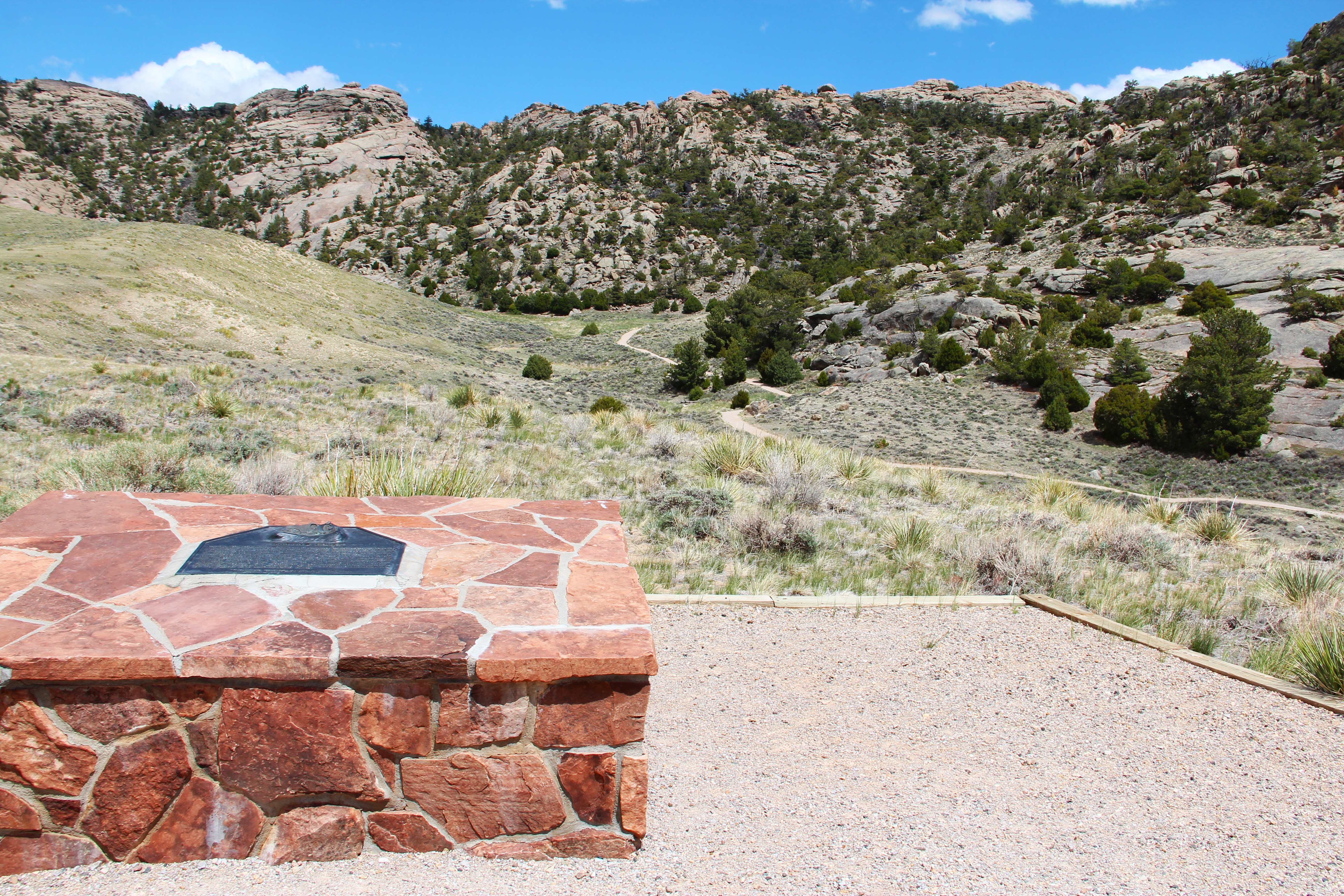
Martin’s Cove: Mormon Trail Site and Martin’s Cove National Historic Site
One of the great tragedies of the overland emigration, the Martin Handcart Company disaster of 1856, occurred in this area of the Sweetwater Valley. The story of the emigrants’ sufferings here and their rescue is well known among members of The Church of Jesus Christ of Latter-day Saints but may be unfamiliar to others. An early winter storm caught the Martin Company of around 600 men, women, and children at a crossing of the North Platte River near Casper, WY, on Oct. 19. These Latter-day Saint emigrants with their handcarts and a small group of rescuers moved through winter conditions while living on starvation rations and reached Devil’s Gate on Nov. 2. Lacking adequate clothing in sub-zero temperatures, they tried to shelter in or near the remains of an abandoned trading post known as Fort Seminoe. Two days later the company, aided by the rescuers, moved a couple of miles west and forded the Sweetwater River, about 100 feet wide and choked with ice. The emigrants took shelter in a cove in the Sweetwater Rocks, on the north side of the valley. Powerful winds and heavy snow knocked down many tents, leaving people exposed to the elements. Unable to move due to snow and sub-zero temperatures, they stayed with little shelter and provisions for 5 days at that place, now called Martin’s Cove. John Kirkman, then 8 years old, later recalled, “Death had taken a heavy toll and the Ravine was like an overcrowded tomb. No mortal tongue could describe the suffering.” When the weather warmed on Nov. 9, the company started west with help from the rescuers and 2 small Latter-day Saint wagon trains with around 430 emigrants, which had followed the handcarts on the journey and sheltered near Devil’s Gate. The freight from the wagon trains was unloaded into Fort Seminoe so that the weakest of the emigrants could ride in the emptied wagons. Additional rescuers with provisions and wagons from Salt Lake City met them progressively along the way and helped them to the valley, where they began arriving on Nov. 30. Some 100 to 125 members of the Martin Company died along the trail, with most of the deaths occurring between present-day Casper and the Salt Lake Valley. A cattleman named Tom Sun established a ranch at Devil’s Gate in 1872. The ranch, listed as a national historic landmark in 1960, was purchased by The Church of Jesus Christ of Latter-day Saints in 1996. Today the Church operates the original ranch house as Martin’s Cove Visitors’ Center, offering exhibits and a film about the handcart disaster. Nearby, the reconstructed Fort Seminoe and a small museum are open to visitors. Monuments, memorials, and sculptures are found throughout the site. Visitors can hike an ADA-wheelchair-accessible trail to Martin’s Cove from the visitors’ center or drive west along the old state highway to a trailhead closer to the cove. Church-sponsored handcart reenactments set out from here in the summer, and handcarts are available for other visitors to borrow. Site Information Location (Martin’s Cove Visitors’ Center, 47600 W WY-220, Alcova, Wyoming, is about 5 miles southwest of Independence Rock State Park.) Amenities Historical/interpretive information/exhibits; restroom; benches/seating; information-volunteer/staff members present; parking – auto, bus/RV; picnic shelter/pavilion; trailhead; water-drinking/potable; ADA wheelchair accessible paths, handcarts for public use. Free tours. Overnight camping available (daily fee) at Ranch 66 Missionary Village, 10 mi west on WY-220. Safety Considerations More Site Information Oregon National Historic Trail California National Historic Trail Mormon Pioneer National Historic Trail Pony Express National Historic Trail
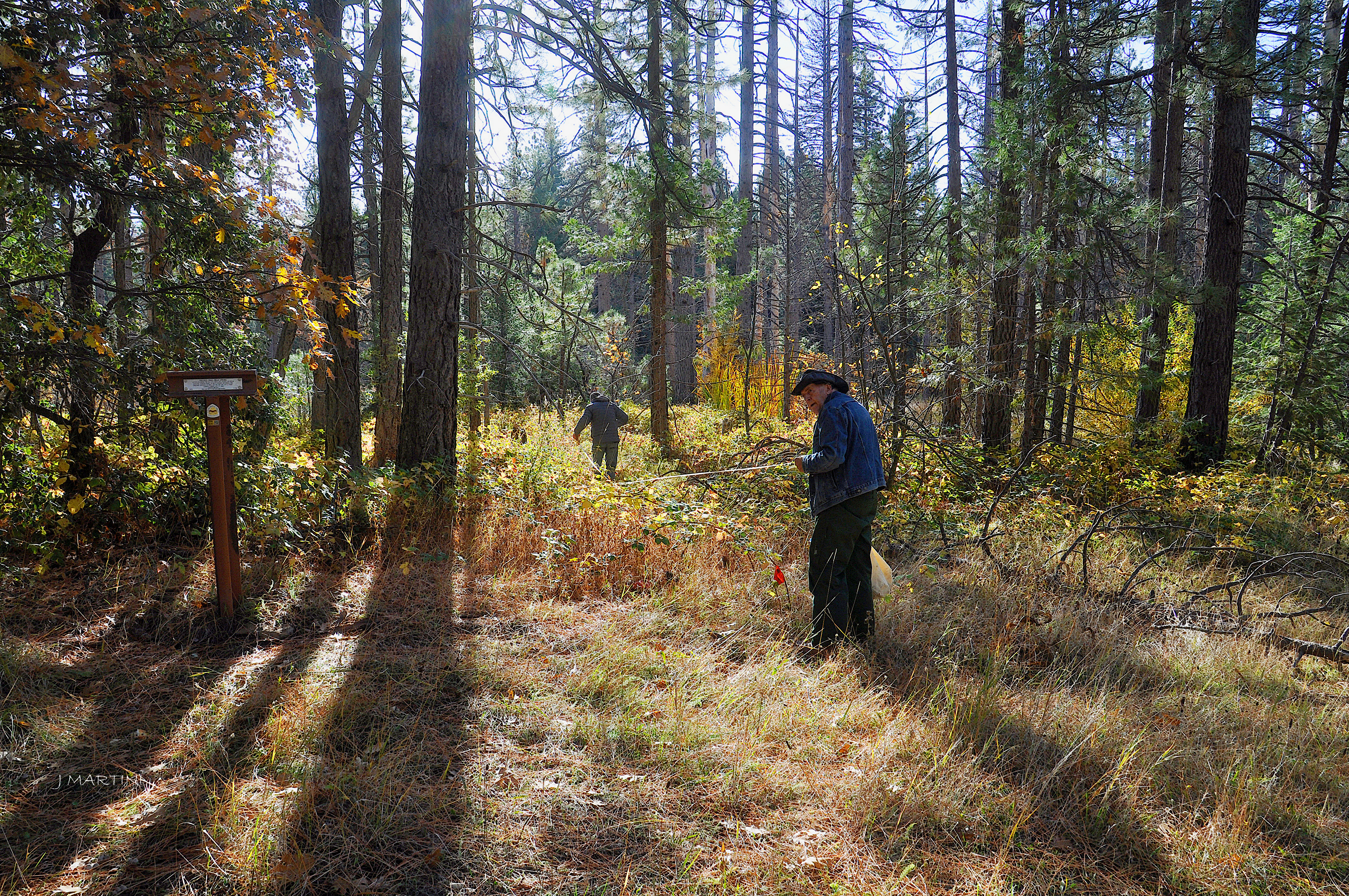
Mule Spring, Truckee Route
Travelers on the Truckee Route of the California Trail often camped at Mule Spring, perched high above Bear River on the west slope of McGuire Mountain in the Sierra Nevada. The site experienced peak emigrant use from 1848 to 1852, when improved roads diverted traffic to other routes. During the gold rush years, some treasure seekers fanned out from Mule Spring to try their luck in the gold fields. Others continued to Johnson’s Rancho, about 45 miles west of the spring, and then to Sacramento to outfit for their mining adventure. Mule Spring figured importantly in the rescue efforts for the Donner-Reed Party, trapped by deep snow east of Donner Summit over the winter of 1846-1847. The first party of rescuers, known as the First Relief, started into the mountains from Johnson’s Rancho near present Wheatland, CA, on Feb. 4, 1847. On the sixth day of travel, their horses and pack mules floundered in chest-deep snow, forcing a halt at Mule Spring. The men cached most of their provisions there and sent one man back to Johnson’s with the pack mules. Leaving a couple boys in camp to guard the supplies and remaining horses, 7 rescuers continued on wearing homemade snowshoes, lugging 50- to 75-pound packs of dried beef and flour through ever-deepening snow. They reached the starvation camp on Feb. 21, the same day the Second Relief started from Johnson’s Rancho. The First Relief brought 18 survivors from the starvation camps into the Mule Spring camp on March 2-3. “We stayed a day or so, getting the horses and mules ready to ride,” wrote 13-year-old Virginia Reed. “No more dragging over the snow, when we were tired, so very tired, but green grass, horses to ride, and plenty to eat.” They rode the remaining 45 miles to safety at Johnson’s Rancho. Mule Spring continued to serve as a base camp and staging area for the remainder of the rescue effort, which continued through mid-April, 1847. Today’s visitors to the site will find a t-shaped trail marker and a clear spring that is partially protected by a covering of weathered planks. Because Mule Spring can be difficult to find, visitors are encouraged to travel with a guide who knows the way. The site lies on public lands about 3 1/2 miles northeast of Dutch Flat and is accessed by a network of unsigned, unpaved, and largely unmaintained roads passable to vehicles with high clearance and 4-wheel drive. From the end of Mule Spring Rd, visitors must park and walk through forest, brush, fallen trees, and marshy ground to find the spring. Site Information Location (Mule Spring Rd., Nevada County, California.) Safety Considerations More Site Information California National Historic Trail
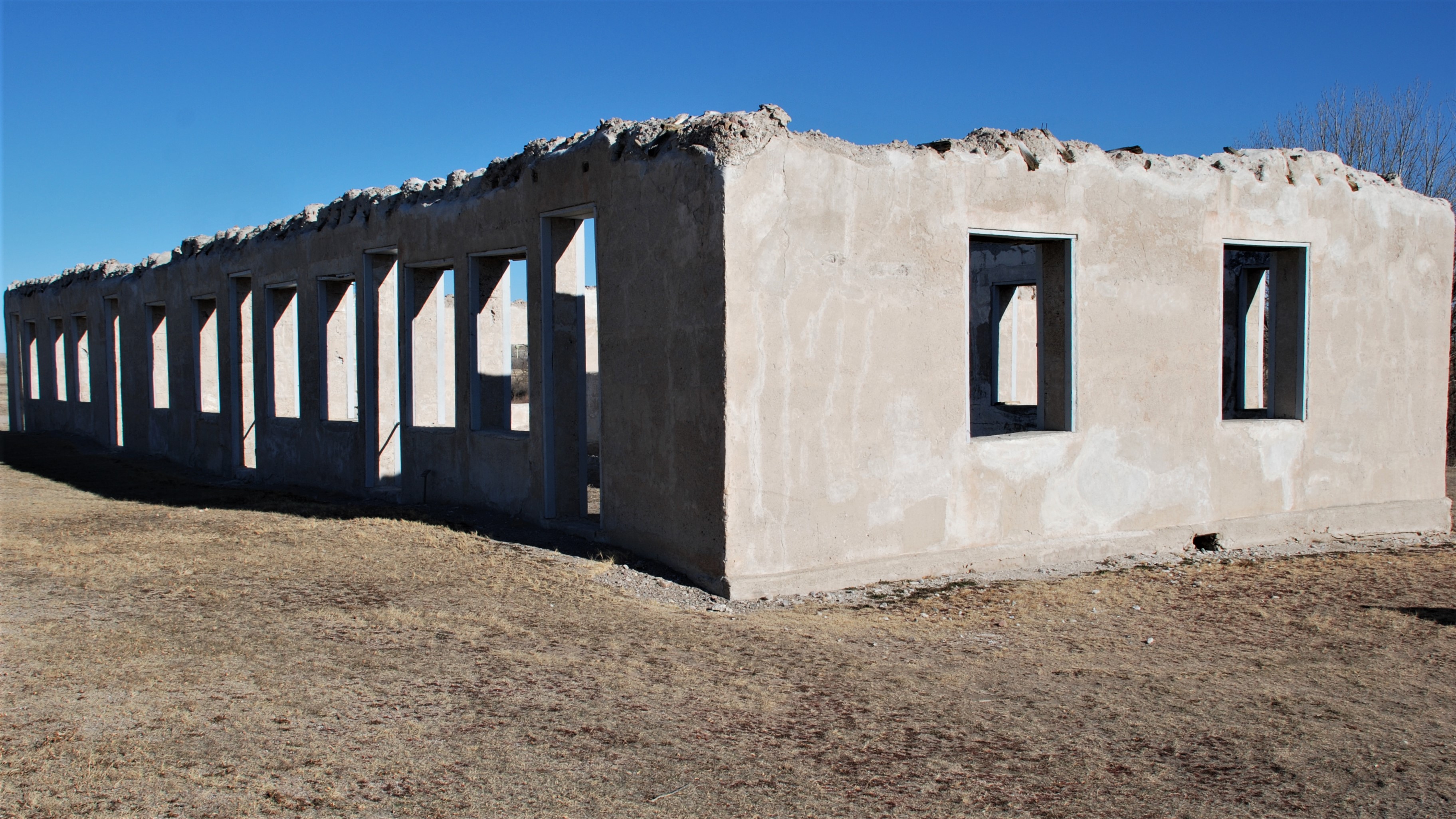
Administration Building Ruins (1885)
Built in 1885, the Administration Building served as the Fort Laramie Headquarters. It also served as the post theater and school. Looking at the interior of the north wall, there is a visible section that shows the marks from wood planks used to make the forms when the concrete was poured. Like many other buildings at Fort Laramie, when this building was sold at public auction, it was stripped of its timber that would be used in construction elsewhere in the vicinity.
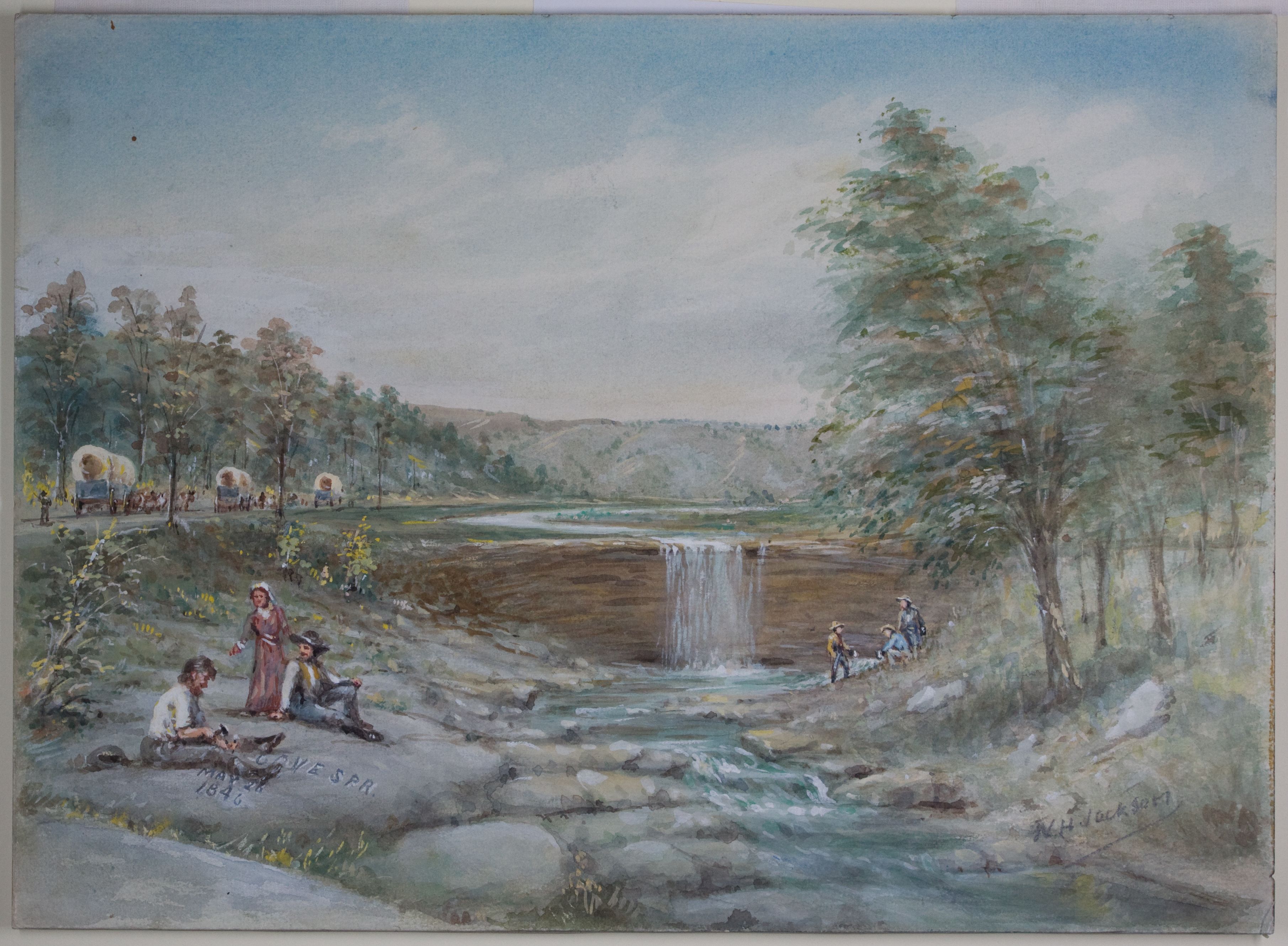
Alcove Spring
Alcove Spring was a favorite trail campsite near the Independence Crossing of the Big Blue River. Often, emigrants would spend several days here, waiting for the swollen waters of the river to drop to levels that were safe for fording. They found the area picturesque, with the spring originating in an unusual rock formation and falling over a rock ledge into a pool below. Emigrants carved their names in the rocks surrounding the spring, and many of these carvings are still visible. The ill-fated Donner Party camped here in 1846 and gave the spring its name. It was also the location of the Donner Party's first recorded death, Sarah H. Keyes, who died from consumption. Emigrant Remarks Edwin Bryant, traveling with the ill-fated Donner-Reed Party, wrote a detailed description of the spring on May 27, 1846: "We found a large spring of water, as cold and pure as if it had just been melted from ice. It gushed from a ledge of rocks, which composes the bank of the stream, and falling some ten feet, its waters are received into a basin. . . . A shelving rock projects over this basin, from which falls a beautiful cascade of water, some ten or twelve feet. The whole is buried in a variety of shrubbery of the richest verdure. . . . Altogether it is one of the most romantic spots I ever saw. . . . We named this the 'Alcove Spring' and future travelers will find the name graven on the rocks, and on the trunks of the trees surrounding it." Site Information Location (6 miles South of Marysville on the East River Road) Today, the spring is part of a 300 acre park. To reach it, follow the quarter mile, easy trail that starts at the parking lot. The park also contains several other hiking trails. Trail Swales (similar to trail ruts) are located nearby at the Alcove Spring Swales. Access the trail across the road from the Alcove Spring parking lot. Safety Considerations More Site Information Exhibit with Audio Description available Oregon National Historic Trail California National Historic Trail
Visitor centers
Park stories
Mormon Pioneer, California, and Pony Express Trails: Echo Canyon Itinerary
Myrtle Creek Ruts Exhibit Audio Description
Mormon Pioneer Trail: Salt Lake City Itinerary
Things to Do in Missouri
Young Man Alone: Snowbound in the Sierra Nevada, 1844
Christmas on the Emigrant Trails: Christmas 1843 at Peachtree Valley, California
Christmas on the Emigrant Trails: Christmas 1846 at Donner Lake, California
Christmas on the Emigrant Trails: Christmas 1849 at Bruff’s Camp, California
Christmas on the Emigrant Trails: Christmas 1849 at Death Valley, California
Christmas on the Emigrant Trails Series
Archy Lee, the California Trail
Alcove Spring Exhibits Audio Description
Park information courtesy of the National Park Service Data API.